Title
Public Access to Forest Service Roads, in the El Dorado National Forest
Author Information
Andrew Cole
American River College, Geography 350: Data Acquisition in GIS; Spring 2013
Contact Information: themissingcard@netscape.net
Abstract
The US Department of Forestry restricts motor vehicle access on many of its forest service roads; however, their distribution of this data is severely outdated and in need of modernization.
Introduction
The El Dorado National Forest is a vast wilderness of mountains, forests, rivers, lakes, and wildlife. This land is public property, so everyone has the right to access this wilderness; however, the US Forest Service is mandated to keep the forest a forest. In order to fulfill this mandate, the Forest Service has the authority to restrict who, when, and how certain areas are accessed and what activities are done on them. A very common and readily understood example of this is when the Forest Service restricts camp fires, when extreme fire danger exists.
The Forest Service is also charged with keeping forest service roads clear; these roads are primarily to provide the forest service and fire service access to as much of the forest as possible. These roads are on public lands and therefore inherently open to the public; however, the Forest Service restricts the public from using motor vehicles on some of these roads.
Background
In order for the Forest Service to restrict the public from using certain forest service roads, they must communicate this to the public. It would be entirely impractical for the forest service to place gates, or even signs, on all the restricted roads, because of the vast number and remoteness of the roads. Instead, the Forest Service produces paper maps, available in their offices and on the internet, that show the roads the public is allowed to access by motor vehicle. These maps are called the "Vehicle Use Map", and are produced for each ranger district within the forest. While these maps do show the public what roads are open to motor vehicle use, they are also very difficult to use and general public awareness of these maps is very low.
There are two main reasons these maps are so difficult to use. The first reason is that the maps only show the roads that are open to public vehicle access; this makes navigating by them very difficult, because sometimes these roads can be very close together and can be easily mistaken. In theory, all the forest service roads have small road designation signs on the corners; however, in the real world many, if not most, of them are damaged, destroyed, unreadable, or all together missing.
The second reason these maps are so difficult to use is the scale of them. The Vehicle Use Maps cover huge areas of land, causing many of the smaller roads on them to be barely visible. In fact, each map has a list of dozens of roads too short to even be printed, but are listed because they are also open for public motor vehicle use.
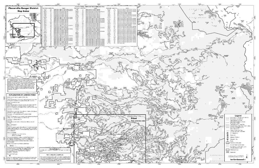
This is the Vehicle Use Map for the Placerville Ranger District, of the El Dorado National Forest.
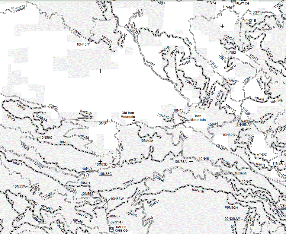
This is a zoomed in look at a small piece of the map.
Methods
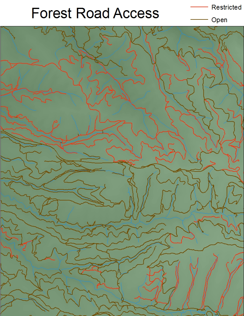
In order to make the data from the Vehicle Use Map relevant, I decided to obtain and modify the US Forest Service's road data layer. The Forest Service had a shapefile of all roads that passed through the forests readily available on its website. Since this data set did not contain any data pertaining to public vehicle access, I decided to add a field to hold this information.
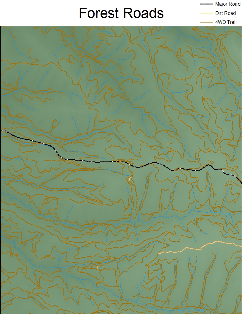
This is the raw road data symbolized by simplified road type.
The data set was complete in terms of showing all the roads; however, it did not contain the route number for most of the smaller forest service roads. This made manually coding roads very difficult, since the Vehicle Use Maps only showed the roads that were open to public vehicles. So I had one map with only some roads showing and the other map was missing many of the roads labeled. Fortunately, there was enough showing and labeled, that I was able to extrapolate the data from what was available.
The manual identification and coding of these roads was a very slow process; therefore, I created a reduced size sample area to reduce the data to a manageable quantity. Using this reduced sample area, also allowed me to limit the size of my data to 8GB; this was an important number, as it is the size of the flash drive I was using to store my project.
Results
For my sample area 1/3 of the total distance of roads was closed to public vehicle access. This number is much higher than I expected to find; while it is not the majority, it is still a significant number. I used total distance to compare the open and restricted access roads because it better represents how much road is actually restricted.
When the data is presented in number of road segments, we find that the numbers only change by less than 10%. In this case, restricted roads represent about 25% of the road segments.
Analysis
If 1/4 of the roads and 1/3 of the road distance is restricted, then we can expect that most of the general public, which does not know about the Vehicle Use Map, does inadvertently drive on restricted roads. This suggests that the Forest Service is not effectively enacting or enforcing its vehicle use restrictions.
In order to validate this assumption, future research could use various means to get data about inadvertent forest road restriction violations. The Forest Service dispatch unit should have logs, and possible statistics, of Forest Rangers contacting persons, or being reported to, of violations of the restrictions. Of course, Forest Rangers are spread out very thin and cannot be expected to observe and respond to every person who violates the vehicle use restrictions; therefore, the use of surveys and checkpoint monitoring would allow a better picture of the actual frequency of violations. All of these methods would still only be able to cover a fraction of the area and give a glimpse of truth; therefore, a more efficient means seems to be more logical.
I believe most people are inherently decent, and would mostly follow the restrictions most of the time, if they knew about them; therefore, I think boosting awareness, access, and usability of this data would be the best, most efficient approach to solving this problem.
Conclusion
The Forest Service should collaborate with the major GPS, Vehicle Navigation, and mapping companies to enable people to have better access to the data, in a more usable format. This would allow people on Google Maps, using a handheld GPS, or using a vehicle navigation system to know, or be alerted, what roads were restricted and whether they were indeed on roads they are allowed to be on. In particular, integration with vehicle navigation systems would raise awareness of these restrictions by presenting it to drivers on the spot.
References
"Vehicle Use Map" for the Placerville Ranger District, of the El Dorado National Forest.
Obtained from the El Dorado National Forest website: http://www.fs.usda.gov/detail/eldorado/maps-pubs/?cid=stelprdb5357470